Discuss Daggerfall Unity and Daggerfall Tools for Unity.
-
Magicono43
- Posts: 1141
- Joined: Tue Nov 06, 2018 7:06 am
-
Magicono43
- Posts: 1141
- Joined: Tue Nov 06, 2018 7:06 am
-
Magicono43
- Posts: 1141
- Joined: Tue Nov 06, 2018 7:06 am
-
Magicono43
- Posts: 1141
- Joined: Tue Nov 06, 2018 7:06 am
-
Magicono43
- Posts: 1141
- Joined: Tue Nov 06, 2018 7:06 am
-
Magicono43
- Posts: 1141
- Joined: Tue Nov 06, 2018 7:06 am
Post
by Magicono43 »

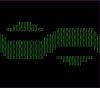
- Daggerfall "Woods.wld" heightmap data exported to human-readable image in green, borders included and location dots as their correct colors
- DFU_Map_Woods.wld_W_All_Locs_16.png (128.17 KiB) Viewed 3361 times